


Ian Transforming into a Major Hurricane
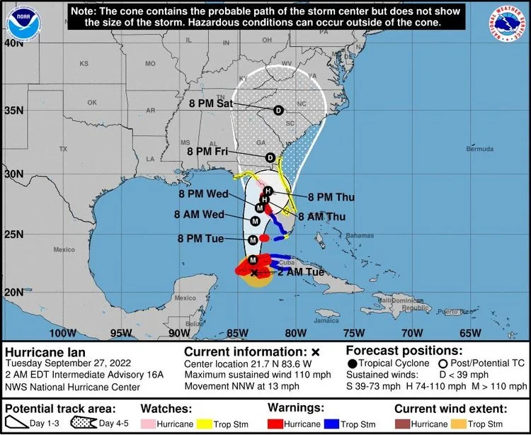
Hurricane Ian’s forecast track, issued by the National Hurricane Center on Tuesday at 2 am. (NOAA/ National Hurricane Center)
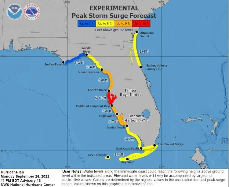
Experimental Peak Storm Surge Forecast, issued by the National Hurricane Center on Monday at 11 pm. (NOAA/ National Hurricane Center)
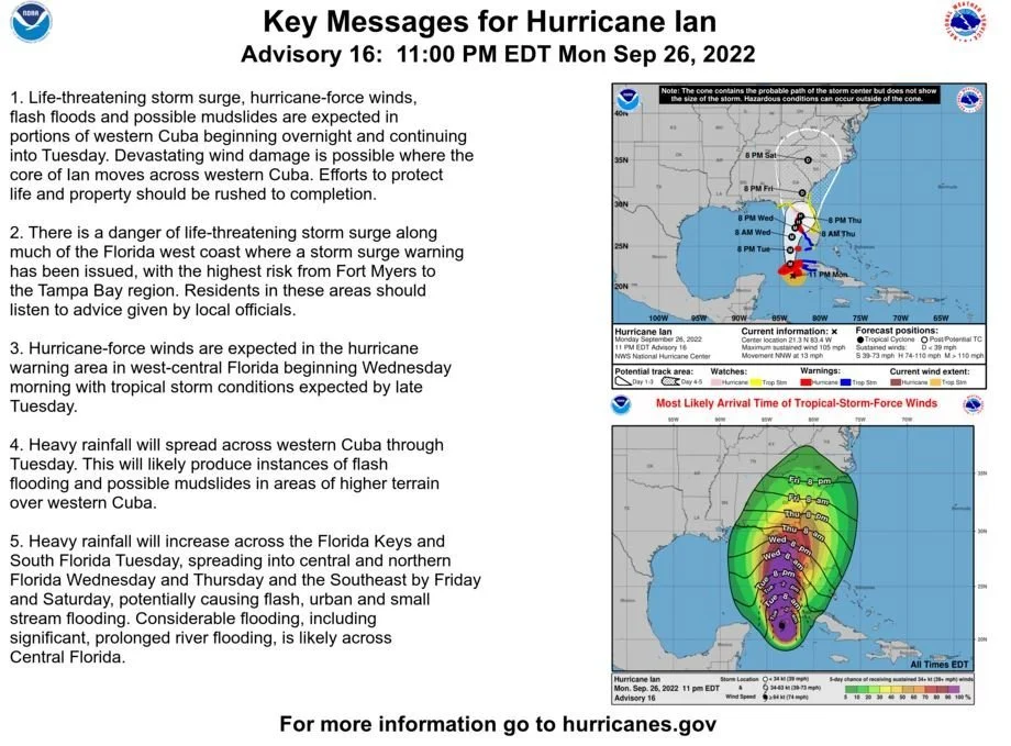
Hurricane Ian is quickly approaching. Its maximum sustained winds increased to 110mph early Tuesday morning. The National Hurricane Center shows the projected path of Ian to travel more east into the state than previous projected paths indicated. This could potentially mean a more significant impact for more Florida residents around the Tampa Bay Area. Gov. Ron DeSantis declared a statewide emergency stating Ian could hit the state as a Category 4 hurricane, with wind speeds topping 130 mph. The Hurricane is expected to hit Tampa as soon as Wednesday.
The NOAA predicts unprecedented storm surge levels that could be catastrophic to the Tampa Bay Area. What we all love about the Tampa Bay Area, like the world-class beaches, canal-front living, and waterfront downtowns, makes Tampa so dangerous and susceptible to storms. Due to expected prolonged power outages and lack of resources, most of the Bay Area’s elected officials have decided to put their counties under an evacuation notice and declare a state of emergency. (Click County Links to be directed towns County Evacuation Notices and Maps)
Hillsborough County ordered a mandatory evacuation for residents in Zone A, and residents in Zone B are strongly suggested to evacuate voluntarily.
Pasco and Hernando County released voluntary evacuation notices for all residents West of US-19 and parts of the counties East of US-19.
Pinellas County issued a mandatory evacuation of 6 p.m. Monday for Zone A and Tuesday at 7 a.m. for Zone B and C.
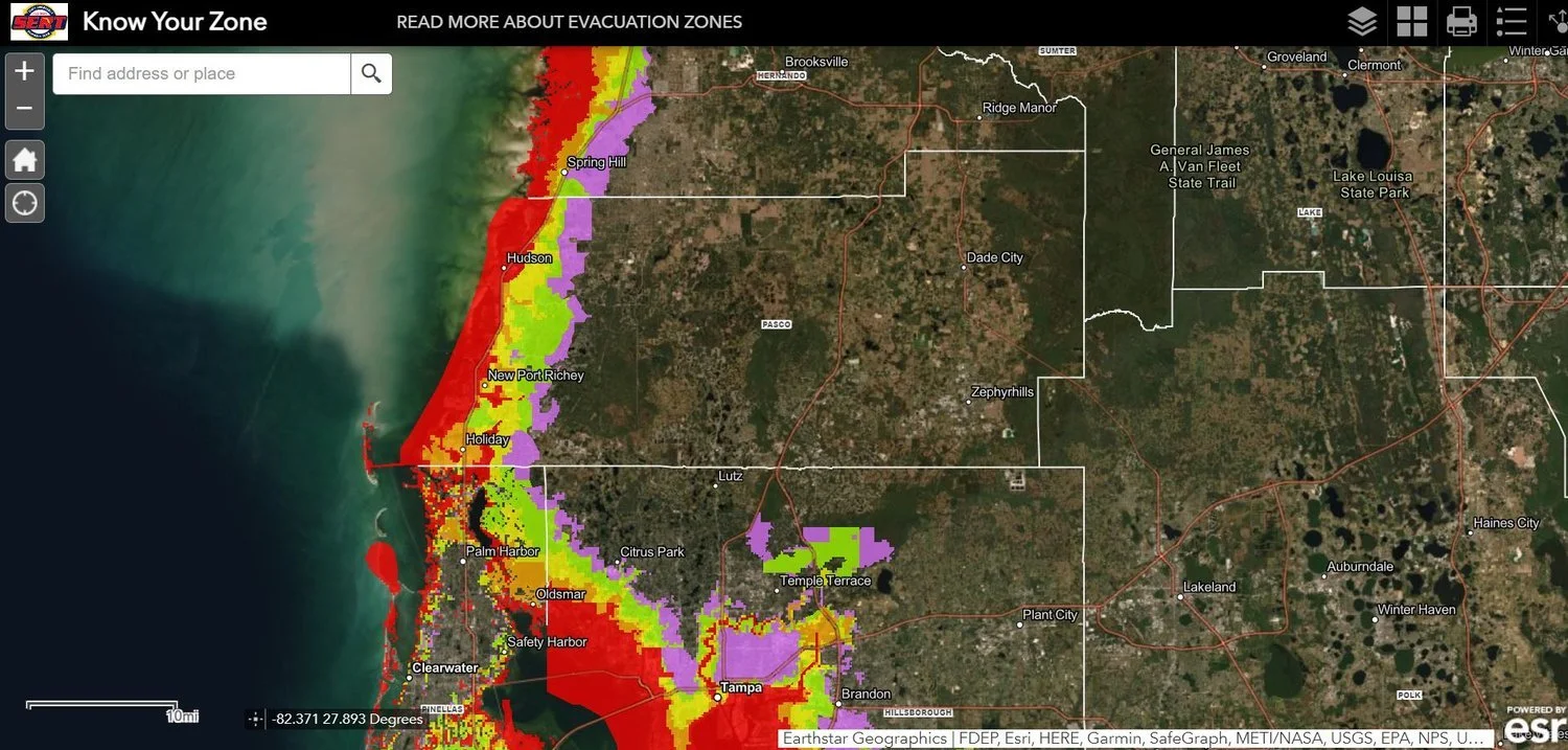
Evacuation Zones Map issued by Floridadisaster.org
Click on Photo Above or Click Here to Access Map